Your Cart is Empty
English


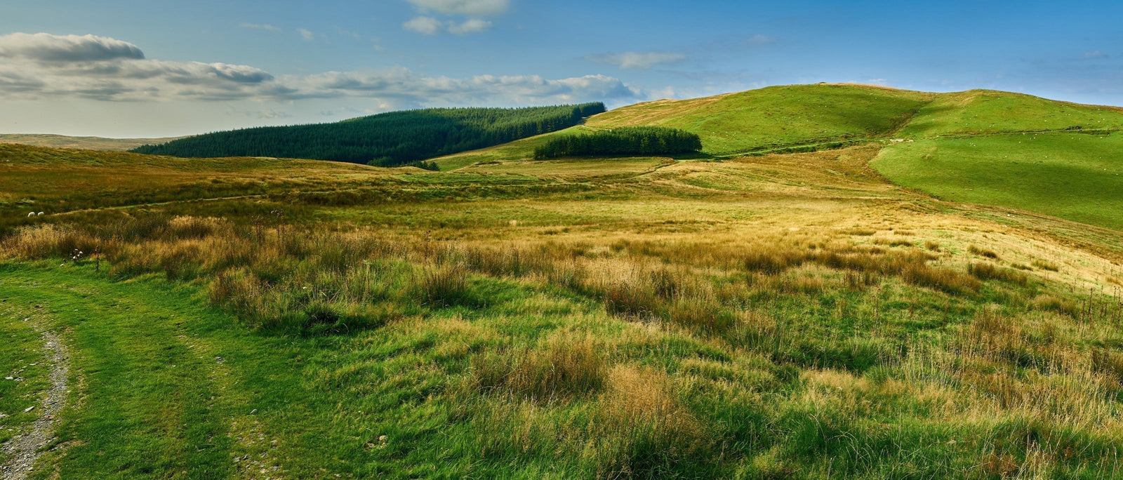
The only sound was the exuberant legato song of skylarks overhead. I looked up and spotted a lone male hanging in the breeze. He trilled without pause as he fluttered ever higher, his effortless, liquid warble flowing across the landscape. I was glad of his merry company. For otherwise, this place seemed comparatively empty. All I could see in every direction was a rolling, featureless landscape of rough hills, festooned with tussocky grass. This was the Elenydd, the ‘green desert of Wales’. Stretching across the uplands of the Cambrian Mountains, it was proving to be the loneliest section of Glyndŵr’s Way yet and it seemed entirely possible that this was also the loneliest landscape in the whole of Wales. Isolated and remote, it would be a good place to go if you were looking for solitude – or if you didn’t want to be found.

Owain Glyndŵr himself was one such fugitive. The semi-mythical figure to which this looping 135-mile National Trail owes its name, Glyndŵr was a Welsh leader who instigated a fierce campaign of defiance against English rule in Wales during the late Middle Ages. He was also the last native Welshman to hold the title Prince of Wales, and today he has become an enduring symbol of Welsh nationalism. In 2004, he placed second in a poll of ‘100 Welsh Heroes’, behind 20th-century welfare pioneer Aneurin Bevan – and just in front of full-throated crooner Tom Jones. That seems a remarkable feat for a man who lived and died more than 600 years ago.
But Glyndŵr’s popular reputation is apparently evergreen. His legend grew after his death and by the late 1500s Shakespeare encapsulated the prevailing view of him as a noble, mysterious and subversive hero: the original freedom fighter. In Henry IV, Part I, he turns up as the noble and proud Owen Glendower. In Act III, Scene I, fellow rebel Sir Edmund Mortimer proclaims him, “A worthy gentleman / Exceedingly well read, and profited / In strange concealments, valiant as a lion / And as wondrous affable and as bountiful / As mines of India.” High praise indeed.

While the bard may have idealised Glyndŵr, what is undeniable is that at the height of the Welsh Revolt in 1405, his rebellion posed a serious threat to Henry IV’s rule. French, Breton and Scottish supporters had rallied to the cause of the oppressed and persecuted Welsh, attacking England on multiple fronts. The following years saw the rebel forces win victories over English soldiers at battlegrounds as far away as Birmingham. But ultimately, Glyndŵr was thwarted by the shrewd tactic of economic blockade, as the king’s forces cut off trade and supplies to most of north and central Wales. In late 1407, Owain’s Aberystwyth Castle surrendered while he was away fighting elsewhere. Harlech Castle fell two years later, and Owain’s wife Margaret, along with two of his daughters, were imprisoned in the Tower of London, where they would all perish.

Glyndŵr’s tale turned to tragedy: he was still a free man, but a hunted one, an outlaw driven to avenge the loss of his ancestral home and beloved family. He fought on until 1412, making successful raids and ambushes on the hated English, before disappearing, apparently without trace. What became of Owain Glyndŵr is uncertain. He was never captured or betrayed, and ignored several offers of royal pardons from the new king, Henry V. Did he die? Did he assume a new identity and live out the rest of his life in secrecy? We’ll never know, but inevitably, various legends abound. It could – and probably should – be Netflix’s next must-watch series.
The romance and mystery surrounding Owain Glyndŵr made him the perfect focus for a national trail. He was the ideal figurehead around which to create a route exploring the heartland of mid-Wales. The trail was duly unveiled in 2000, looking simultaneously forward and back, to the beginning of the new millennium whilst acknowledging the 600th anniversary of the Welsh Revolt. The walk officially begins in Knighton, which lies largely in Powys but partly in Shropshire. Cutting across a broad swathe of countryside, the trail then links various small market towns and quiet villages to reach Machynlleth, where Glyndŵr’s parliament sat in 1404. Here the route swings eastwards again, returning across Wales via Lake Vyrnwy to Welshpool, finishing just four miles from the English-Welsh border. Along the way, the path plunges through oak woodland, follows forgotten drove roads, crosses upland mire and heath, and wanders along ancient hedgerows.

Despite having been established for two decades now, it has not proven to be one of our most popular National Trails. You’ll see far more walkers tackling the South West Coast Path, or the Pennine Way, or even Offa’s Dyke. That is a shame, for what Glyndŵr’s Way perhaps lacks in terms of outright drama (somewhat ironic given that Owain’s life was one of uninterrupted drama from beginning to mysterious end), it makes up for in historical interest and lush countryside, not to mention a deep sense of tranquillity almost from start to finish. This is not a trail that takes your breath away or makes your jaw drop, though there are plenty of picturesque sections. Instead, it’s a walk that slowly wins you over with its peaceful air and beguiling charm.

This isn’t to suggest that Glyndŵr’s Way is an easy ramble. The Cicerone guidebook to the trail breaks it down into 9 days of walking, plus an extra 2 days along the Offa’s Dyke Path to take you from the finish point back to the start. Each stretch incorporates stiff ascents and knee-jarring descents – particularly if you tackle the optional climb of Pen Pumlumon Fawr, which at 752m (2,467 ft) is the highest point in mid-Wales. This is most certainly proper hill country. In addition, there are occasional boggy moorland sections when gaiters are a good idea. And, on the most exposed tops, you can expect to be occasionally buffeted and battered by everything from intermittent gusts to full-blown gales – the primary reason for the profusion of wind farms that occasionally mar the view. All of these challenges mean that completing the walk, whether you do it in one long backpacking trip or across several weekends, is a genuine achievement.

On the ground, the trail winds and weaves its way from place to place, adding to its leisurely, unhurried feel. One such spur comes late on in the walk, a northern detour to the shore of Llyn Efrynwy (Lake Vyrnwy), which takes in arguably the most impressive man-made structure of the entire route: a mighty stone-built dam, constructed by Victorian engineers to create a reservoir that would supply the distant city of Liverpool with clean water.
The demand for drinking water also helped to create another major reservoir that lies on the trail, again incorporating a hulking dam. This example is similarly imposing but far less grandiose; an impassive grey buttress built in the late 1960s. Clywedog is the tallest concrete dam in the UK, with a height of 72 metres (236ft). At full capacity the reservoir contains approximately 50,000,000,000 litres of water (that’s fifty thousand million, if your eyes have gone squiffy from all those zeros). Gazing down at the curved wall of concrete from a vantage point high above the reservoir, I stood and contemplated this mind-boggling figure.

I had tried not to think about that immense volume of water earlier in the day, as I wandered amongst the atmospheric ruins of Bryntail lead mine, which sits directly beneath the dam on the banks of the Afon Clywedog, not far from the small town of Llanidloes. At its height in the mid-19th century, Bryntail was a busy, smoky, noisy place, supplying the demand from growing towns of the industrial revolution with lead for roofing, pipework, paints and glazing. Today, it feels contrastingly serene. So too does quaint Llanidloes, the first town that backpackers reach on Glyndŵr’s Way, some three days after setting out from Knighton. However, this market town was once the epicentre of the Welsh woollen industry, and the pretty 17th-century timber-framed market hall still survives today.

At Dylife, another former mining area where little now remains but a welcoming inn, you start to head onto higher ground. The optional ascent to reach the trig pillar that marks the summit of Pen Pumlumon Fawr is a long trudge across dank, boggy moorland, but – providing the weather is clear – you are rewarded with fabulous and far-reaching 360-degree views. Not far from the summit is the source of the River Wye, and slightly further south is the source of the River Severn. A third river, the Rheidol, also rises nearby. Welsh folklore has it that old father Pumlumon had three daughters, which today give the rivers their name. When the time came for the girls to leave home, Pumlumon promised each daughter as much land as she could cover in a single day. The first daughter, Severn (Hafren in Welsh) woke at dawn and hurried away to the north, covering an enormous distance before curving around to reach the sea. Wye woke later, taking a more direct route south, but still covering plenty of ground. Rheidol, the laziest daughter, awoke later still, and realised she would have to make a direct beeline westward to get to the sea if she were to claim any inheritance at all.

I felt more like Rheidol than Hafren on leaving Dylife, but still took time to divert to the placid moorland pool of Glaslyn, whose waters lapped gently on the shingle bank. It was a reflective place to sit as I shrugged off my pack and swigged from my water bottle. I would soon be approaching the tongue-twisting town of Machynlleth, the halfway point of the walk and the place that, more than any other on Glyndŵr’s Way, has bona fide historical associations with the great man himself. I was excited to get there – but I was feeling the miles in my legs. Leaving Glaslyn, I passed a particularly weather-beaten marker post, encrusted with mosses and lichens. It was marked not just with the iconic acorn symbol of the National Trails, but also with a slightly faded yet still discernible dragon, replete with an elaborately coiled tail. I traced the serpentine form with a finger and wondered whether this waymark was also some sort of joke, a visual metaphor for the route’s meandering yet mesmeric course.

From here the trail broadly follows the Dyfi Valley, offering tantalising glimpses of southern Snowdonia as you progress east. Farm tracks and paths cross rounded, grassy hills, then lead through thickly-wooded Dyfnant Forest to the aforementioned Lake Vyrnwy. The little village of Meifod is the lowest point on the route after Machynlleth. Inevitably, getting there and then getting out again involves plenty of up-and-down walking. Indeed, you could say the same about the trail as a whole – if you walk the whole of Glyndŵr’s Way, the total elevation gain is some 23,629ft (7,202m). As it happens, that’s exactly the same height as Singhi Kangri, a mighty peak in the Karakoram range. And though finishing a fairly long walk across mid-Wales might not come with the same sense of triumph as an expedition to a far-flung mountain, it does offer plenty of quiet satisfaction. You are also amply rewarded in other ways. I’d gained a new and deep affection for this peaceful, often-bypassed ribbon of Wales. It’s a place that lies at the nation’s heart, just like Owain Glyndŵr himself.