Your Cart is Empty
English


In late June 2023, I made the long drive from my home in Sweden to the Jotunheimen National Park in Norway. With a few supplies and my 12-year-old dog in tow, I set off to hike the Besseggen Ridge – a trail I’d dreamed of completing for several years.
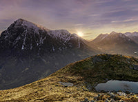
The Jotunheimen National Park, otherwise known as “The Home of the Giants,” consists of over 250 mountains. It’s home to 29 of the largest mountains in Norway, including the highest peak in Northern Europe – Galdhøpiggen at 2,469 metres (8,100 ft).
My journey to this spectacular park took around eight hours by car from Örebro (Sweden), driving through the moose-filled forests of Varmland and the soft rolling mountains of Eastern Norway. The further west I travelled, the more dramatic the landscape became. The rolling green hills of the east gradually turned more raw, with jagged cliff faces and snow-capped peaks.
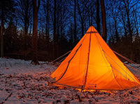
After the demanding but rewarding drive, I made it to my overnight spot – a small pitch on the banks of Øvre Sjodalsvatnet around 20 minutes from the Besseggen trailhead at Gjendesheim. I set up the tent and took a refreshing dip in the ice-cold waters of the lake before sitting back and enjoying the view of the mountains under the midnight sun.
Tomorrow was going to be a big day. I’d finally get to hike the trail I’d dreamed about for so long…

Located in the Jotunheimen National Park, Besseggen is a 14 km route across a mountain ridge that follows the length of Lake Gjende. It takes six to eight hours to complete, with a total elevation of 1,100 metres (3,600 ft), the highest point being Veslefjellet at 1,743 metres (5,718 ft) above sea level.
“Forged by Thor on the anvil of Earth,” the Besseggen Ridge is one of the most popular hikes in Norway. An estimated 60,000 hikers complete the trail every year.
The trail goes between two small ferry ports – Gjendesheim and Memurubu. Hikers have the option of hiking the trail one way and making use of the ferry to travel back to their start point. Alternatively, the trail can be completed both ways with an overnight stop at Memurubu in one of the small mountain cabins or a tent.
The trail is rated as “challenging,” and there are several steep sections that require hikers to use their hands and feet to cross the rugged terrain. One part of the trail is particularly difficult and is certainly not for the faint-hearted. Hikers must climb or descend (depending on the direction of travel) an almost vertical ridge with a sheer drop of over 1000 metres on each side. This section can become congested on busy days, making it all the more dangerous.
I don’t recommend doing this hike in rainy or windy conditions because the steep sections on the exposed ridge require firm and careful footing. I also don’t recommend Besseggen if you don’t have any alpine hiking experience. If you don’t feel comfortable taking on the challenge alone, it’s possible to book a trip with a mountain guide. Alternatively, there are several easier hikes with views of Lake Gjende in the area that are more suited to beginners.
Now you know a bit about Besseggen, let me tell you about my experience hiking the ridge with my old, loyal mountain dog, Marley…

The most popular way to complete the Besseggen Trail is to take the small ferry across the glacial waters of Lake Gjende to Memurubu before hiking back to Gjendesheim. This route allows you to walk the trail without any time restraints, making for an altogether less stressful experience.
Rather than go with the grain, I decided to hike the opposite way, heading toward Memurubu and catching the ferry back to the trailhead in Gjendesheim.
The route I took saw far less foot traffic, which meant I could enjoy the spectacular scenery without a convoy of people walking ahead of me. However, if you plan on making it back to Gjendesheim on the same day, you have to be certain you’ll reach Memurubu in time for the last ferry at 17:55.
My journey began from the Gjendesheim car park, which is roughly two kilometres from the ferry port and trailhead. A shuttle bus from the car park that takes you to the ferry port leaves a few times in the morning and again in the evening. A ticket for parking and a return trip on the shuttle bus can be purchased from one of the pay-and-display machines or the staff on site.
You can walk along the road to the trailhead, but I recommend taking the shuttle bus to save time and energy if you plan on completing the trail over the course of the day.

Once at the ferry port, the Besseggen trailhead is clearly marked and sits just beside a small convenience store at the base of the ridge.
The ascent to Veslefjellet from Gjendesheim was stress-free and enjoyable. With good weather, well-trodden trails, and a gradual incline (for the most part), we were in good spirits.
The first part of the trail meanders over a gentle alpine landscape littered with berry bushes, heather, and smooth boulders that have been softened from snow melt over millennia. On the trail, I was greeted with warm sunshine and clear views over the turquoise glacial waters of Lake Gjende.
It was hard not to stop regularly during the ascent to take in the ever-increasing panoramic views of my surroundings. Luckily, I had an excuse to take it easy on this part of the trail as Marley took regular stops to drink from the mountain streams. I’d regret this laid-back attitude a bit later in the hike…
This was also a good opportunity to fill up a couple of bottles with water. The water is safe to drink along the entirety of the trail, but running streams become sparse when you reach Veslefjellet.
As I continued to gain elevation, the terrain became more demanding.
The trail reaches a memorable viewpoint with a small sign reading, “Enjoy the view and turn around if you spent more than 2 hours from Gjendesheim.” Although vague in wording, this sign notifies hikers of the danger of spending too much time on the trail. If you’re too slow, you’ll either miss the ferry or find trouble on the high alpine ridge. “No problem for me,” I thought. It had only taken a little over an hour to reach this point.

The viewpoint sits below a short but steep climb that can seem daunting, especially when you’ve got a little old dog in tow. There are chains to help hikers climb up and over the smooth rock face. This section was rather slippery during my trip due to recent snow melt from higher up the ridge.
At this point, I had to secure the dog in my pack – something he hadn’t experienced for a couple of years. Regardless, he settled and, with a firm and careful footing, we passed over this short, challenging section.

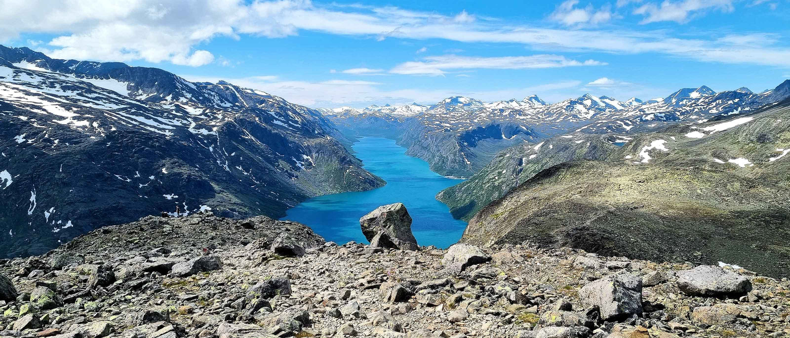
The trail from here opened a window exposing the towering peaks that roll across the Jotunheimen National Park. One way, you have views of the breathtaking glacial lake and river. The other way, you’re met with views over jagged, snow-capped mountaintops.
After a 45-minute hike up a relatively steep section of the trail and a crossing at the top of a small waterfall, I reached the start of Veslefjellet – the highest point of the trail.

I was greeted with vast mountain landscapes and cool alpine air. The colours of the trail had now changed from soft shades of green and brown to greys, whites, and deep blues.
It had been a while since I was last in the mountains, and a wave of emotion rushed over me. As cliché as it sounds, I felt like I was home once again.
The next section of the trail runs over the highest point (Veslefjellet) to Bessvatnet – a mountain lake that sits at 1374 metres (4507 ft) above sea level.
The walk across Veslefjellet takes you over a rocky plateau known as “the roof of Besseggen.” It has a few ups and downs and can be demanding at times. This section of the hike takes you slightly inland away from Lake Gjende, opening up beautiful views of the surrounding peaks.

Being there in late June, the plateau was mostly clear of snow. However, there were a few patches I had to cross. Areas of snow in the mountains can be deceiving at this time of year, covering cavities that have been hollowed out through melt during the summer months. If you must cross over them, follow the trodden path made by other hikers or go around if you can.
Marley wasn’t too happy about crossing the snow. I think he was having flashbacks from last year’s harsh winter back in Sweden. I had to pick him up to pass over these sections, but there was no need to put him in the pack just yet. With regular breaks to give him water from a bottle I’d filled earlier, he was doing just fine putting in the miles on his own four paws.

As you gain altitude on the plateau, you start to catch glimpses of Bessvatnet. You follow alongside the lake at height until you reach a point where the plateau makes a descent, opening up views down the length of Lake Gjende.
There’s a fantastic viewpoint before the trail descends to the famous ridge between Bessvatnet and Gjende. Here, you can look over the emerald waters of Lake Gjende with a rolling backdrop of the jagged snow-capped peaks of Jotunheimen.

This was the perfect place to stop for a light snack and some water before continuing, I thought. I reached into my pack to grab an egg from a few I’d boiled in the morning, only to find them completely crushed and inedible. Rookie move – I completely forgot they were in there when I put the dog in the pack earlier on the trail…
“Oh well,” I thought. “A few peanuts will have to do.”
Moving on, I started to descend further from Veslefjellet toward Bandet, which translates to ‘strip’ or ‘ribbon’. This narrow ridge separates the blue waters of Bessvatnet and the emerald-green waters of Gjende. The contrast of the two lakes is spectacular. I recommend stopping to take in the view because the trail from here gets a lot more demanding.
The view over Bandet is breathtaking but rather daunting. I was so struck by the beauty of it that I almost failed to spot the steep, exposed ridge that lay in my path.

This is where Besseggen really tested me.
As I made my way down toward Bandet, the descent gradually became steeper and steeper before reaching a narrow, near-vertical section that would require some light climbing.
There was only one option here. I had to secure Marley in my pack, making sure he wouldn’t be able to fidget his way out of the opening.

Once Marley was secure and I’d tightened up the waist and chest straps of my backpack, I began my descent of this steep, narrow ridge. To say this was challenging for me is an understatement. Since the majority of the other hikers on the trail were climbing up the ridge, there was a lot of stopping and shuffling to let people pass.
I passed several hikers that were utterly terrified, and to be honest, I was pretty scared as well. With the weight of my dog in the pack and the inability to shuffle down forward, I had to scale the face with my back to the 1000-metre (3280 ft) sheer drop beside me.
Progress was slow, and the steep ridge seemed endless. However, after several heart-in-the-mouth moments, the route eased up and became more manageable.

This was undoubtedly the most challenging and technical section of the trail. If you have a fear of heights and aren’t confident with this style of hiking, the Besseggen trail is probably not for you. Luckily, it’s a relatively short – although unavoidable – section of the trail, and it doesn’t get any worse than this.
After the steep ridge, there’s a demanding but less intimidating hike to the base. The last stretch to Bandet involves crossing relatively large boulders, so Marley remained in my backpack for the duration of this section.
Once we reached the bottom, I released the dog from the clutches of my pack so he could stretch his legs and take a drink from Bessvatnet. We proceeded onwards over the narrow stretch of land between the two lakes.
The trail continues around the end of Bessvatnet before curving left, where it makes an ascent back up the ridge. It’s a relatively gradual and easy climb, but I did start to flag from the lack of food and the intensity of the last part of the trail.
I really had to push myself through the next section, digging deep for every ounce of strength I had. My thighs were burning, and fatigue was setting in. It dawned on me that I’m not as fit as I once was, probably due to the lack of any major hiking over the past year.
The trail seemed endless at this point, and not only was I feeling exhausted, but I could see that Marley was too. He was slowing down and had to keep stopping, bless him. I decided to load him into my pack to take the weight off his paws for a while.

Of course, with a dog of his age, this was absolutely necessary. If you have an old, small dog, I encourage you to bring them out hiking with you. However, you must leave enough room in your backpack for when the trail gets rough or they become tired.
The extra weight in my pack didn’t make things any easier for me, but the dog was happy, and that’s all that matters. Fueled by a dwindling supply of peanuts and water, I powered onwards and upwards to Bjørnbøltjønne – a small but beautiful alpine lake.
I was grateful to finally make it to the lake. I found a fresh stream of snowmelt flowing into the still water to fill my bottle with and let Marley out for a drink and a quick stroll before putting him back in the pack.

The view of the ridge is spectacular from there. I would’ve loved to have stopped for a proper rest before moving onwards, but I had the pressure of time looming over me. After working out how quickly I’d covered the last few kilometres and assessing the distance to Memurubu, I’d need to move fast if I were to catch the last ferry. This one was going to be close.
The next section of the trail was very up and down. Following further alongside Lake Gjende, the ridge becomes more open and exposed to the elements. The crosswinds on this section were crazy, making progress difficult. The winds brought with them fine mountain rain that, although uncomfortable at times, was rather refreshing.
Although the changing weather and strong winds made things challenging, the views of the lake and the mountains around continued to impress.

To my right, colours of blue and white from a distant glacier stood out from the black rock of the mountains in an otherwise barren landscape. To my left, bright turquoise waters and glimpses of Memurubu in the distance.
Every sight of the small ferry port and dense cluster of cabins that made up Memurubu gave me a lift of energy. I was pretty exhausted by this point, and so was Marley; he spent the rest of the trip comfortably in my backpack.
This last stretch was a test of physical and mental strength. Every seasoned hiker knows that feeling where the trail seems to become endless, climbing to a peak just to see the trail slope back down and back up a steep incline in the distance. This feeling seemed to go on forever until finally, the endless ups and downs broke, and the port came into view ahead.
With Memurubu in sight, I checked the time and saw that we had a little under an hour to make it to the last ferry.

Motivated by the thought of a hot meal and a cold beer at camp, I hurried down the mountain toward Memurubu. My surroundings quickly changed from the rugged, rocky landscapes of the mountains to the soft pine-laden forests of the valleys.
Emerging from the trees, I was met with a small group of log cabins and a gravel path down to the ferry port.
Finally, I reached the port with 15 minutes to spare. I sat down, got the dog out of my pack, and enjoyed the moment. I had a great sense of achievement, sitting by that small port utterly exhausted. This wasn’t the longest day hike I’d ever done, but it was definitely the most challenging.
A short while later, the ferry arrived.
I hopped on board and paid the toll before heading up to the top deck to admire the view. The ferry ride back was spectacular. It was wonderful to follow the Besseggen Ridge back to Gjendesheim from the comfort of the ferry.

Seeing the route I had just hiked from this angle was incredible. The ride back gave me time to take in what I’d achieved and relive the experience as I passed memorable points like the steep ridge to Bandet and the ascent to Veslefjellet.
After a short 20-minute ferry ride, we arrived back in Gjendesheim. I quickly stopped in the convenience store to grab a bottle of sparkling water and a “Kvikk Lunsj” (a Norwegian KitKat), before getting on the shuttle bus to the car park. I’ve never enjoyed a chocolate bar so much in my life; it made the hefty price tag worth it!
I reached the car and, after a short drive up the road, I found a simple campsite alongside a clear trout stream. After a hearty portion of pesto pasta, the evening was spent fishing and relaxing in this beautiful part of Norway before getting an early night to refresh for tomorrow’s adventures…
 |
 |