Your Cart is Empty
English


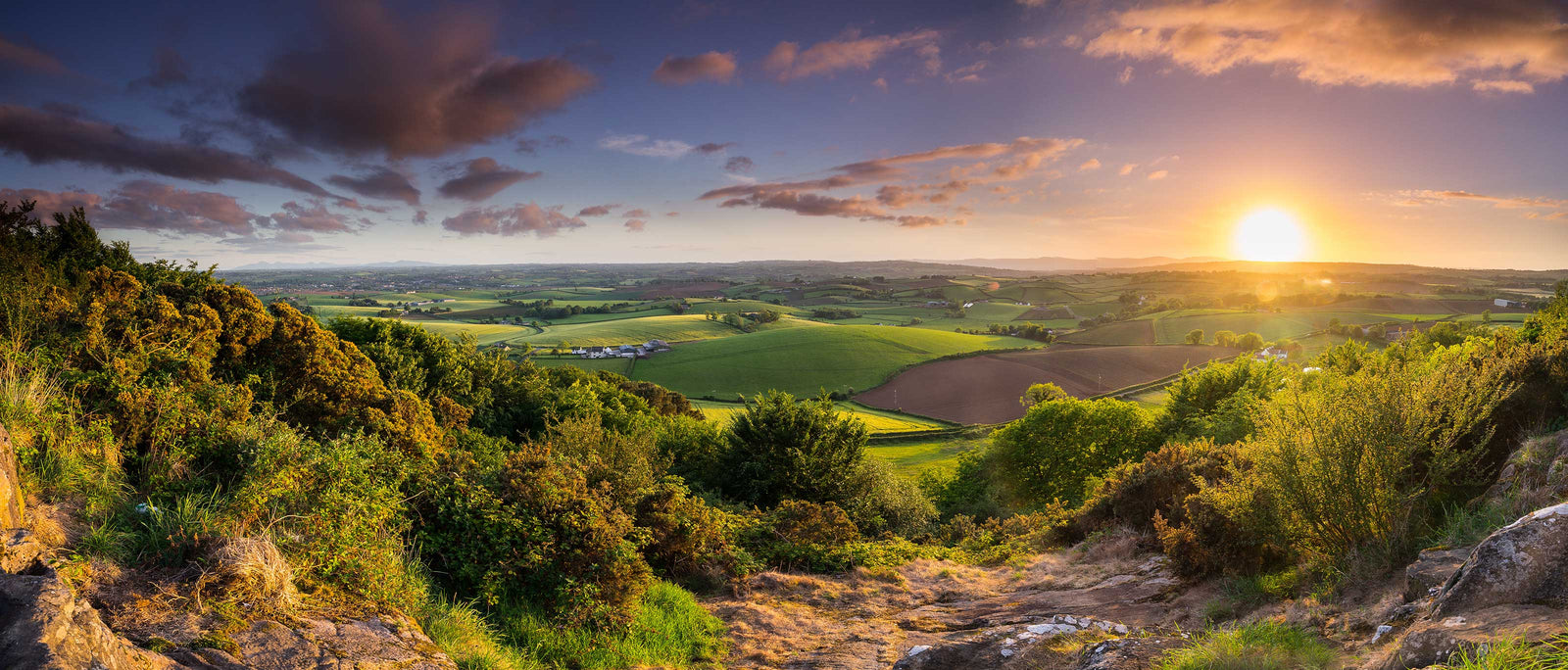
Beautiful Northern Ireland encompasses six counties on the Emerald Isle, namely Antrim, Armagh, Down, Fermanagh, Derry and Tyrone. Famed for their stunning Celtic scenery including boglands, heathlands, lakelands, mountains and legendary coastlines, all once trodden by mythical giants in worlds gone by; it’s no wonder the north has so many stunning hikes to choose from.
Each of Northern Ireland’s six counties is utterly unique. In County Antrim, for instance, you might find yourself walking beside coastal bird colonies, towering rock formations and craggy cliffs one morning, and then heading further inland through majestic glens, mystical forests and undulating hills the next. Much like the weather, no two landscapes or days are the same in this part of the world.

Another great thing about Northern Ireland is its compactness. You could visit for two weeks, for example, and tick an enormous number of activities off your bucket list. Starting in Belfast (where you’ll find Belfast International and Belfast City airports), you could start in the Belfast Hills and road-trip your way up towards the Antrim coastline for stunning hikes by the Irish Sea.
From there, you might head towards the Sperrin Mountains and challenge yourself to climb Sawel Mountain, before heading south west towards the mighty Cuilcagh Boardwalk trail and the surrounding lakelands of Fermanagh. Wherever you end up, you’re never too far from the next adventure.

Here’s our pick of some of the best hikes in the beautiful country of Northern Ireland.

Slieve Donard is Northern Ireland’s highest peak at 850m (2,790ft). Situated amongst the mystical Mourne Mountains, this mighty climb takes you along the Glen River, past streams and forests of pine, birch and oak, towards a panoramic view from the summit. On a clear day you can spot the Isle of Man in the Irish Sea, the Wicklow Mountains in the south, Lough Neagh in the north, and even Donegal way out west. The main route is an out-and-back ascent via the Glen River Track, though you could also try the quieter Bloody Bridge route via the Bloody River.
This is a challenging hike with significant elevation gain on rough, often boggy terrain. The upper section becomes steep and rocky, requiring sure footing and some scrambling near the summit. Best suited to walkers with some hill experience; not recommended for complete beginners in poor conditions.
The coastal town of Newcastle sits at the foot of the mountain and offers the widest range of accommodation in the area, from the grand Slieve Donard Resort & Spa to a range of B&Bs and self-catering cottages. For something more remote, the villages of Annalong and Kilkeel to the south offer quieter bases within easy reach of the Mournes.

Otherwise known as Fermanagh’s stairway to heaven, the Cuilcagh Boardwalk trail crosses one of Northern Ireland’s largest blanket bogs via tracks, boardwalks and staircases. Following a route of roughly 7 miles (including the walk from the car park), the walk takes around two to four hours and culminates in a stunning ascent of Cuilcagh Mountain, offering magnificent views across the county’s surrounding lowlands. Check out our handy field guide to County Fermanagh if you’re looking for more fun activities in this part of the country.
Moderate to challenging. The lower sections follow well-maintained boardwalks that make the boggy terrain manageable underfoot, but the final ascent to the summit is steep and exposed. The wooden staircase eases the hardest section considerably, making this more accessible than many comparable mountain routes – though a reasonable level of fitness is still required.
Enniskillen, around 20 miles north, is the main hub for accommodation in County Fermanagh, with hotels, guesthouses and self-catering options to suit most budgets. For a more immersive experience, a handful of rural B&Bs and farm stays operate closer to the trailhead in the Marble Arch area – well worth seeking out for the peace and quiet alone.

Starting at the Navan centre in Armagh and ending in the grounds of Down cathedral in Downpatrick, Saint Patrick’s Way connects some of the key Christian heritage sites relating to Saint Patrick, the patron saint of Ireland. It’s both a pilgrimage and a long-distance hike, so is one of the less remote hiking trails in this sense, taking you through a combination of on and off-road trails in order to reach these sites of interest. Beyond St. Patrick’s Cathedral, the final resting place of the saint, other areas of interest include the Mourne Mountains, the Murlough Bay Nature Reserve, Carlingford Lough, the Newry Canal, and Tyrella Beach, to name a few.
Moderate overall, though this varies considerably across the route's 82 miles. Much of the trail follows quiet roads and well-maintained paths rather than open mountain terrain, making it more accessible than purely off-road long-distance routes. That said, the multi-day commitment requires good physical preparation and solid navigation skills for the less well-marked sections.
Given the route's length and variety, accommodation options are plentiful along the way. Armagh city offers a good range of hotels and guesthouses at the start, while Downpatrick at the trail's end has several comfortable B&Bs. In between, the towns of Newry and Castlewellan make useful overnight stops, and the Mourne Mountains section passes close enough to Newcastle to make it a natural mid-route base.

Slemish Mountain (Slieve Mish), the first known home of Saint Patrick, sits 437m (1,434ft) above sea level and is the core of an extinct volcano. According to local histories, it is where Saint Patrick was enslaved to the local chieftain Mulchi, and spent 6 years herding livestock. While steep in some places, requiring a scramble here and there, the ascent is rewarded with a panoramic 360-degree view of the surrounding counties including the Antrim Hills, the Mourne Mountains, Lough Neagh and the Sperrins to the west. Due to its short distance, this hike is an excellent choice for those just starting out in hill and mountain walking.
Short but steep. The route gains height quickly on rocky, uneven ground, and a brief scramble near the top means walkers should be comfortable on rough terrain. Despite the technical moments, the brevity of the route makes it achievable for most people with a reasonable level of fitness – just don't underestimate it based on the distance alone.
The market town of Ballymena, around seven miles away, is the most practical base, with a solid range of hotels and guesthouses. The village of Broughshane itself, directly below the mountain, has a quieter, more rural feel – a handful of B&Bs operate in the area and it's a pleasant spot to linger if you're not in a rush.

Taking in County Antrim’s iconic coastline, the Causeway Coast Way is situated in the north-east of Northern Ireland and passes through the Causeway Coast Area of Outstanding Beauty (Ireland’s only World Heritage Site), and several other Areas of Special Scientific Interest. It also crosses paths with many popular attractions including the Giant’s Causeway, the Carrick-a-Rede Rope Bridge, Dunluce Castle and the Bushmills distillery, the oldest licensed whiskey distillery in the world. The trail itself mostly follows the coastline, hugging craggy cliffs, isolated beaches, and large sections of The Ulster Way. With the highest point of the trail being just over 140m, this trail is suitable for both experienced and novice hikers.
Relatively accessible for a coastal long-distance route. The terrain is varied – cliff-top paths, beach sections and some road walking – but rarely technical, and the modest elevation keeps things manageable. The main challenge is the cumulative distance over two days rather than any single strenuous section. Good footwear is recommended; coastal paths can be slippery after rain.
The trail is well-served with accommodation throughout. Portstewart and Portrush at the western end offer the widest choice of hotels and guesthouses, while Bushmills – handily close to the Giant's Causeway – has several characterful options including the Bushmills Inn. At the eastern end, Ballycastle is a pleasant overnight stop with a range of B&Bs and a lively town centre to recover in.

A perfect day out if you’re staying (or living) in or near Belfast, Cave Hill park is a bucket list hike in Northern Ireland. Situated just north of the city, it has an elevation of 368m, culminating in incredible views across the country's capital. There are some impressive historic points of interest along the way too, including McArt’s Fort, Ballyaghagan Rath, Carrs Glen Mill, the Devil’s Punchbowl and more. The paths are mostly unsurfaced and can get pretty muddy on rainy days, so make sure you’ve got a good pair of waterproof boots to see you through the whole hike. It’s worth noting that the Cave Hill summit walk follows the green way-marked arrows.
Moderate. The route climbs steadily from Belfast Castle on mainly unsurfaced paths, with some steeper sections near the summit. Nothing technically demanding, but the terrain can be boggy and slippery in wet weather – which in Belfast is a reasonable expectation at most times of year. Suitable for walkers of most experience levels with appropriate footwear.
Being a city hike, Cave Hill is best combined with a stay in Belfast itself, where accommodation ranges from budget hostels to some excellent independent hotels in the Cathedral Quarter and beyond. For something a little different, there are a few B&Bs in the leafy north Belfast suburbs close to the trailhead – handy if you want to get on the hill early.

Spanning 40 miles, the Sperrin mountain range is the largest in Ireland. It stretches through the counties of Tyrone and Derry and includes ten summits above 500m, the highest being Sawel Mountain at 678m (2,224ft). Peaks aside, there’s also the Gortin Glen Forest Park, Banagher Forest and Altnaheglish Reservoir, Carntogher Way, Sli Cnoc Breac (Crockback Way), Moydamlaght Forest and many more. Including boglands, stone circles, valleys, heather-laden hills and lakes for miles and miles, there are a huge variety of landscapes to explore here.
Variable – and that's part of the appeal. The Sperrins offer everything from gentle forest walks and valley paths suitable for beginners to the more demanding open ridge routes over Sawel Mountain and Mullaghclogha. The absence of crowds also means navigation skills are more important here than on more popular routes, particularly in poor visibility.
Cookstown and Omagh are the main towns serving the Sperrins on the Tyrone side, each with a range of hotels and B&Bs. Limavady makes a good base for the Derry flanks of the range. For a more immersive stay, several rural guesthouses and self-catering properties are dotted through the glens – the An Creagán visitor centre near Creggan also offers on-site accommodation and is a useful starting point for exploring the wider area.

The Ulster Way is the longest hiking trail on the entire Emerald Isle. It’s a circular route crossing the Mourne mountains, the Giant’s Causeway, the spine of the Sperrins, the uplands of the Fermanagh lakelands, and a whole lot more. It also takes in all six counties of Northern Ireland in one go. More of a multi-week (or even a multi-month) expedition than a quick hiking trail for a sunny Sunday afternoon, the Ulster Way consists of primarily waymarked paths, and a few non-waymarked sections along the way.
Demanding, by virtue of its sheer scale rather than any single section. Terrain ranges from coastal paths and forest tracks to open mountain and bogland, and fitness requirements vary dramatically depending on which section you're tackling. For those attempting the full route, excellent physical preparation, solid navigation skills and experience in remote conditions are essential. Tackling it in sections over multiple trips is a perfectly sensible – and increasingly popular – approach.
Given the route circumnavigates the entire country, accommodation options are almost limitless. The trail passes through or near most of Northern Ireland's major towns, making it straightforward to plan overnight stops at regular intervals. For multi-week thru-hikers, the Visit Northern Ireland website maintains up-to-date accommodation listings tied to the route's waypoints – well worth consulting before you set off.

Beginning in Rathlin Island Harbour and ending at the West Lighthouse, the Rathlin Trail is a fantastic way to explore the island in its entirety. The island itself is only 4 miles east to west (and 2.5 miles north to south), so you can really take time to soak up the landscape and study its fascinating geology and wildlife. This is the only inhabited offshore island in Northern Ireland, but the population consists of a mere 141 people, so there’s a unique sense of solitude to the hike too. Surrounded by sea cliffs, Rathlin supports the largest seabird breeding colonies in Northern Ireland, with puffins arriving in spring, so don’t forget to check out highlights such as Knockans RSPB and the Kebble nature reserve as well.
Moderate. The terrain is largely manageable on well-worn paths and tracks, but exposed coastal sections and some uneven ground mean good footwear is essential. The biggest logistical challenge is the ferry crossing from Ballycastle, which is weather-dependent – always check sailings before you go, and build in flexibility if you're planning an overnight stay.
Rathlin itself has a small number of accommodation options, including the Rathlin Island Hostel and a few self-catering cottages – booking well ahead is strongly advised in spring and summer. If you're day-tripping, Ballycastle on the mainland is the natural base, with a good range of B&Bs and guesthouses a short walk from the ferry terminal.

Nestled in the Belfast Hills is the Divis and Black Mountain trail, a short hike in the beautiful county of Antrim. Whilst there are quite a few routes to choose from including the summit trail (3 miles), the heath trail (4 miles) and the lough trail (0.9 miles), the ridge trail is a great contender for a slightly longer outdoor adventure, taking a circular route across stunning grasslands and boglands that offer 180-degree views across Belfast and beyond. Other highlights include birdwatching for skylarks, the historic Bobby Stone, the Collin River and much, much more.
Moderate. The ridge trail involves some steady climbing on open, exposed moorland, and the paths can be boggy underfoot in wet conditions. No technical difficulty to speak of, but a reasonable level of fitness helps – particularly on the approach from the lower car park. Waymarking is generally good; follow the National Trust signs throughout.
As with Cave Hill, Belfast city centre is the most practical base, with a wide range of accommodation across all price points. The National Trust car park at Divis is accessible by public transport from the city, making it easy to stay centrally and still get on the hill without a car.
Late spring and summer – broadly May through to August – offer the most reliable conditions for hiking in Northern Ireland, with longer daylight hours, milder temperatures and the best chance of settled weather. That said, the country's Atlantic climate means rain is always possible regardless of season, so waterproofs are a year-round essential rather than an optional extra.
Autumn brings spectacular colour to the glens and forests, making September and October genuinely rewarding for lower-level routes, while spring is particularly worthwhile on the coast – Rathlin Island's puffin colonies arrive from around April, and the wildflowers along the Causeway Coast are at their best from May onwards. Winter hiking is certainly possible on many routes, but shorter days, exposed ridgelines and boggy ground mean the higher mountain routes such as Slieve Donard are best left to experienced walkers with full winter kit.
There's something for every level of experience. Northern Ireland's range of terrain means you'll find everything from gentle coastal ambles and well-surfaced forest trails to serious mountain ascents requiring navigation skills and a head for heights.
Accessible introductions include the Causeway Coast Way, Cave Hill and the lower sections of the Sperrins – all manageable for reasonably fit walkers with no specialist experience. For something more demanding, Slieve Donard and the Cuilcagh Boardwalk Trail offer genuine mountain challenges, while the full Ulster Way is firmly in expedition territory. As a general rule, always carry a map and compass on any hill route, tell someone your plans, and check the weather forecast before heading out – Northern Ireland's mountains may not be the highest in the British Isles, but conditions can deteriorate quickly.
Absolutely – as some of the entries on this list will hopefully have made clear, Northern Ireland punches well above its weight for long-distance routes. The Ulster Way at 636 miles is the standout, circumnavigating all six counties in a route that most walkers tackle in sections over multiple trips rather than in a single continuous effort. Saint Patrick's Way offers a more focused multi-day experience at 82 miles, connecting Armagh and Downpatrick across six to ten days of walking.
For those wanting a taste of multi-day hiking without committing to a major expedition, the Causeway Coast Way covers 31.5 miles over a very manageable two days, with excellent accommodation and transport links throughout. There is no right to wild camp in Northern Ireland but it is unofficially tolerated in many areas (provided you respect the landowner and abide by leave no trace principles), opening up further options for those who prefer to carry their home on their back.
 |
 |